Posts

Mapping Intermission - Flags!

Image
 I designed these flags a long time ago now, and it finally occurred to me I should post them here, and use one as my blog icon! Check them out: Above, the civilian flag of Embla. This is the flag used by civilian individuals or organizations, and is the most commonly known flag outside of the country. It symbolizes a prominent constellation which rises in the West and is thus commonly visible throughout the country. Above, the official flag of the government of Embla. This is used on all government property, and by the military. I'm thinking that there might be minor variations of this flag through history, as the government system goes through changes. It symbolizes the people and land united together in the nation.  The flag above is the Civil Ensign. An ensign is just a flag flown on a boat, so this is the flag flown on civilian craft. This is the Naval Ensign, the flag flown on naval vessels.  And finally for a sort of fun, obscure one I created a "diplomatic" flag (

Sketching Cities & Major Roads

Image
It's been a minute! I've been thinking and dreaming up lots of ideas, but I've been so busy lately I haven't put pen to paper (or mouse to pad?) on anything Embla related. Honestly I do feel overwhelmed; its hard to turn a creative idea into reality. I also have a (somewhat vain) concern about how my country will look "under construction" because I know that the OGF community has high standards. Anyway, the game plan is to start on the highest levels and keep sifting down into the details, like a pixelated image coming into focus. Here is a first draft sketch of population centers, roads and railways: Key: - Roads: Red = Motorway, Orange = Primary, Yellow = Secondary - Rail: Blue - Population: Black Dot, larger = more people. Comment if  you have questions or suggestions!

Finally Finished River System!

Image
After much procrastination and so many JOSM conflicts ITS DONE! (for now) I have uploaded my major rivers and the lake to OGF. I'm so satisfied to finally see something on my map! There is still a lot of refining to do, but at this point, I think that I should save the most detailed edits for when I'm building towns and cities along these rivers.  I detailed some of the process in Inkscape in my last post, but I'll briefly cover the rest here. I imported my SVG file into JOSM and scaled it to match the country, and placed it as well as I could. Next, I went literally river by river, connecting them to each other and to the ocean as needed. This revealed lots of odd elements from Inkscape, like overlapping loops, etc that had to be deleted or altered to make sense. It was really fun to be able to scale, rotate, and move each river into position. It's almost like playing in a sandbox, and so fun to imagine the topography as you place each river. At this point, I'

River Refining + Mountain Range Design

Image
I'm continuing to build out my riparian system for Embla. I've also been working a lot on a Conlang/naming language, which has got me really excited about putting more things on the map! I was worried my previous rivers weren't at a realistic scale or pattern for the type of mountain range I had in mind. I have been looking on OpenTopo map for a lot of mountain range inspiration! Something I have found extremely helpful is to practice tracing real mountain ranges & river systems on Inkscape. Using the regular pencil tool, trace a rough line along the highest ridges of a small portion of a range. I color this red for contrast, then start in blue to color the rivers/streams. After doing this a couple times, it's given me a much better feel for how the rivers actually look in the type of range I want to create in west-central Embla. Here's what I have ended up with: The greyed out background is the currently uploaded river system. Blue is new rivers, red are

Elevation Map Draft 2

Image
Map Makeover: Embla Edition The Before: The After: *ooh* *ahh* *yaaas* *work it*

Revised Elevation Map

Image
I spent some more time playing around with the river systems and decided to shift things from the last draft. I'm not sure about the lake geography. I'm going to try to look for examples of other lakes to better refine the size. I definitely want some kind of large-ish lake in the middle, but there will be other finger lakes in the northern mountains, I haven't reached that level of detail yet. Next steps are tracing this map into JOSM to get a rough outline of rivers and some administrative boundaries. The dotted lines are what I envision as states/districts/region type things. The Northern district is the biggest but also likely the less populated. The middle two will probably have about even population, the capital city is in the middle district at the mouth of the largest river. I'm excited to design that area eventually. The southern two districts are much smaller. I'm not sure if having them split into two is justified unless there was another major city cente

Draft Elevation Map!

Image
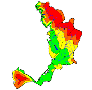
Following the advice of OGF's Making Realistic Countries , I used Inkscape to trace Embla and draw a preliminary elevation map: Which I then used to imagine some major waterways, mostly rivers and some lakes: And then from there, I placed cities and large towns where people might be most likely to settle: I'm definitely going to continue to tweak the elevation model and the rivers. I wanted district/state boundaries to be based on watershed-type areas. I have to think about the terrain outside of my country boundaries as well, to make things look continuous and more realistic. I'm very happy with this rough draft though!